geography

Δ DELTAS


Several studies have noted the temporal coincidence between shoreline erosion around some major deltas (e.g., Nile, Mississippi, Ebro), and the reduction of stream sediment loads due to reforestation, soil conservation practices, and trapping of river sediment behind dams. There are, of course, excellent reasons to suspect a causal link, but the link itself has not, in my view, been fully established.

THE CYCLE OF EROSION


Out on the trails of Shaker Village at Pleasant Hill, Kentucky, this morning, I got to thinking about William Morris Davis’ “cycle of erosion” conceptual model (also called the geographical or geomorphological cycle). The drive-by, oversimplified version is that landscape evolution starts with uplift of a more-or-less planar, low relief surface. Weathering and erosion goes to work, and results in an initial stage of increasing relief as streams carve valleys, and slope processes operate on the slopes thereby created. Eventually, however, as the streams begin to approach base level, a new stage of decreasing relief begins as hilltops and drainage divides are lowered and valleys infilled. This continues until the entire landscape is about as close to baselevel as the geophysics of mass transport will allow, creating a low-relief, almost-planar surface called a peneplain. At some point a new episode of uplift occurs and the cycle begins anew.

I was thinking of this because many landscapes in the world, like the one I was viewing this morning, do give the impression of a dissected plateau or a low-relief surface into which denudational processes have cut.

HYDROPEDOLOGY: FLUX-STRUCTURE INTERACTIONS

Subfields such as biogeomorphology, ecohydrology, geoecology, soil geomorphology are areas of overlap between disciplines and subdisciplines. They are governed by the paradigms of the overlapping fields, and fit more or less comfortably within, and at the boundaries of, those fields. They do not have an independent paradigm or conceptual framework (which in no way reduces their importance or vitality).

Landscape ecology, by contrast, has developed its own paradigm—pattern, process, scale—that is independent from mainstream ecology, biogeography, and geospatial analysis.

Does, or can, hydropedology have such an independent paradigm? Is its development best served by, say, the ecohydrology or soil geomorphology model as an overlap field dominated by existing paradigms of pedology and hydrology? Or is a landscape ecology, separate paradigm direction more appropriate?

OPTIMALITY IN EARTH SURFACE SYSTEMS


A number of theories in geomorphology, ecology, hydrology, etc. are based on the idea that Earth surface systems (ESS) develop according to some optimal principle or goal function. That is, the ESS develops so as to maximize, minimize, equalize, or optimize some quantity—energy, exergy, entropy, work, mass flux, etc.  Some of these notions have some explanatory power and have resulted in some important insights. However, they have always bothered me--no one has ever been able to convince me that there is any inherent, a priori, rule, law, or reason that, e.g., a hillslope or a stream channel or a soil would operate so as to optimize anything. The conservation laws for mass, energy, and momentum are the only laws of nature that absolutely must hold everywhere and always.

So how does one explain the apparent success of some optimality principles in describing, and even predicting, real ESS behavior?

Suppose we use P to represent possible developmental pathways for an ESS. An optimality principle is essentially arguing that a particular P among all those possible is the most likely1. But the sufficient conditions for a particular path need not invoke any extremal or optimal goal functions.

DUST BOWL DYNAMICS

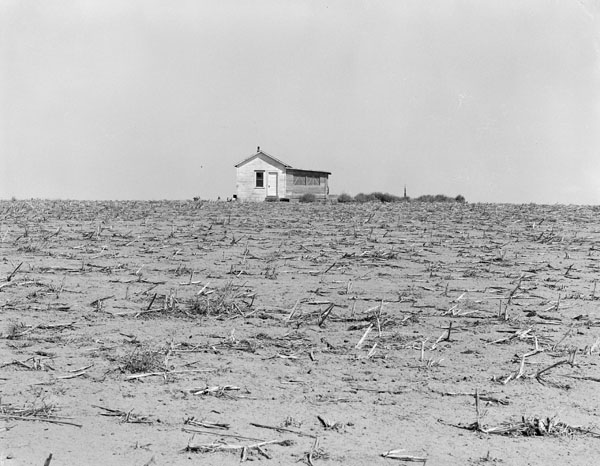
A conversation with other scientists about severe, dust-bowl type wind erosion and erosion risks got me to thinking about the key interrelationships involved. The severe erosion and land degradation in the U.S. Great Plains in the 1930s was a combination of a particular confluence of environmental factors that set up aeolian erosion risk (climate, periodic low soil moisture, topography), a prolonged drought, and human factors (replacing natural grassland vegetation with crops that left fields bare part of the year).  In other areas where the environmental risk factors are present, how stable or resilient is the landscape to severe wind erosion?

Archival photo from Kansas showing cropland degraded by wind erosion in the 1930s. 

THE INHERENT EPHEMERALITY OF WETLANDS

As a citizen, an environmentalist, and a scientist, I am absolutely committed to the conservation and preservation of wetlands. The ecosystem services provided by wetlands are immense; their hydrologic, ecologic, economic, and aesthetic values are long since beyond serious question. However, as we strive to protect these inarguably valuable resources, we need to keep one thing in mind—marshes, swamps, bogs, and other wetlands are inherently and irreducibly subject to change.

First, many of them are geologically ephemeral. They are recently formed and very young in geological terms, and under no circumstances would they be expected to remain static—geomorphically, hydrologically, ecologically, or locationally—for very long. The estuaries of the Gulf coast of the U.S., for example—and their associated tidal flats, salt and freshwater marshes, mangrove swamps, freshwater swamps, etc.—were established in approximately their current locations only about 3000 years ago. That’s nothing in geological time. Even at that, both the external boundaries and internal dynamics have been anything but static in that time, and change is ongoing. This kind of youth and dynamism is the rule, not the exception, for wetlands around the world.

THRESHOLD MODULATION


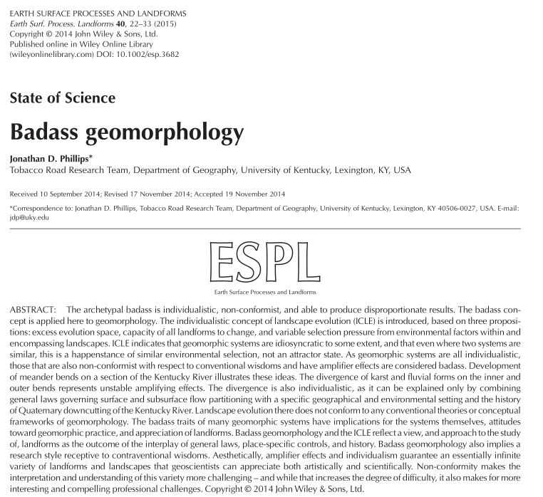
Not too long ago (Phillips, 2014) I proposed that many geomorphic systems are characterized by divergent behavior driven by either self-reinforcing feedbacks, or by “competitive” mutually-limiting relationships. However, this divergent evolution cannot continue indefinitely, and is ultimately limited by some sort of thresholds. Watts et al. (2014) recently published a paper that I think provides a good example of this sort of behavior a bit different from the ones I cited.

In a low-relief karst wetland landscape in Florida, they found that feedbacks among vegetation, nutrient availability, hydroperiod, and rock weathering (dissolution) result in formation of isolated forested wetland depressions (cypress domes) amongst prairie-type wetlands. However, as the cypress dome (they are called domes because of the taller canopies, despite the depressional landform) features grow, water volume thresholds limit further growth. 


Phillips, J.D., 2014. Thresholds, mode-switching and emergent equilibrium in geomorphic systems. Earth Surface Processes and Landforms 39: 71-79.

GEOMORPHOLOGY & INVASIVE SPECIES


Here in the University of Kentucky physical geography program, we have a regular weekly meeting called BRAG (Biogeomorphology Research & Analysis Group) in which various faculty and graduate students from geography and other programs cuss, discuss, debate, and speculate about a wide range of topics centered on geomorphology-ecology interactions. A couple of years ago we focused quite a bit on the biogeomorphic ecosystem engineering effects of invasive species. That led to development of a review paper, which at long last was published, in the Annual Review of Ecology, Evolution, and Systematics—The biogeomorphic impacts of invasive species. The co-authors are myself, Songlin Fei, and Michael Shouse. Songlin, now at Purdue University, was then in the Forestry department at UK, and a regular participant in BRAG. Michael, now at Southern Illinois University-Edwardsville, was then a geography PhD student here.

The abstract is below, and a ScienceDaily news release is here: http://www.sciencedaily.com/releases/2014/12/141211115522.htm

Subscribe to geography